Winter Storm Update from NOAA (National Oceanic & Atmospheric Administration)
Potential for major winter storm late Friday through Sunday
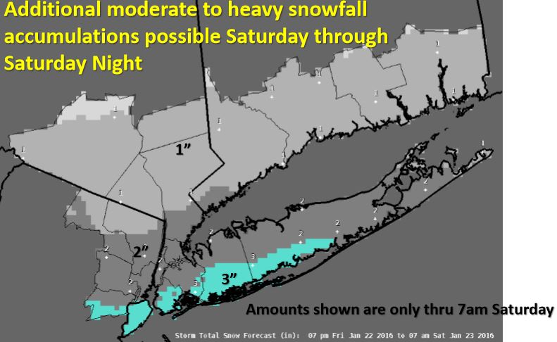
A storm system moving across the U.S. is expected to strengthen rapidly as it reaches the East Coast Friday night and tracks southeast of the region Saturday into Sunday. Greatest accumulation expected through 7:00 am on Saturday.
Potential Hazards
Heavy Snow: Moderate potential for 6+ Inches…with a low potential for 12+ inches. Potential for blizzard conditions (heavy snow + winds of 35+ mph + visibility of ¼ mile or less) Saturday thru Saturday Night.
Coastal Flooding: Potential for Moderate Tidal Flooding around times of High Tide Saturday morning and Saturday night. Potential for significant beach erosion and localized washovers along Atlantic Ocean beaches.
Click here for additional information.