Winter Storm Warnings continue throughout Connecticut as a heavy snowstorm blankets southern New England. The State Emergency Operations Center is activated.
Here's more from NOAA:
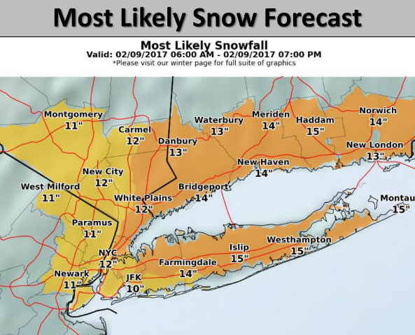
At 11:30 AM: Heavy snow was falling across the entire state with several reports of thundersnow. A very heavy band of snow is occurring from just east of Torrington up to the Springfield area with snowfall rates over 4" per hour. Total snowfall thus far ranges from 10" - 14" across the state. Roads are snow covered with visibilities down to 1/10th of a mile at times. Temperatures are currently in the mid to upper 20's. Northeast winds are sustained at 10 - 15 MPH, gusting to 40 MPH at times. Driving conditions are very poor on all state roads.
This Afternoon: The snow should begin to lighten up during the next 60 minutes in Western CT and in the Hartford / New Haven area after 1:00 PM. The snow is forecast to end completely by 3:00 PM in Western CT, 5:00 PM in the Hartford area and by 7:00 PM in Eastern CT. Blowing and drifting of the snow is expected with north winds gusting to 25 - 40 MPH. The impact on the afternoon rush hour is expected to be at the high end of moderate with some snow cover remaining on most roads and temperatures in the upper 20's.