The National Weather Service (NWS) has issued an alert for Severe Thunderstorms that are poossible Wednesday afternoon and evening.
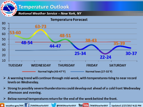
According to the NWS, a warm frontal on Tuesday night will result in temperatures on Wednesday to reach near record levels, with highs in the 60s to lower 70s. An approaching cold front could act on this mild and unstable air mass to produce strong to severe thunderstorms Wednesday afternoon and evening.
Damaging wind gusts of 60 mph or more, brief torrential rainfall, and frequent cloud to ground lightning are possible with the stronger storms.
Please follow NWS official forecasts via the links below for further details and updates.
N