A slow moving cold front will approach the region tonight, Monday, October 23 and slowly cross the area tomorrow into early Wednesday.
Gusty winds are expected ahead of the front, with the potential for damaging wind gusts in any heavier showers or thunderstorms tomorrow and tomorrow night. These conditions may continue into Wednesday morning across southeastern Connecticut and eastern Long Island.
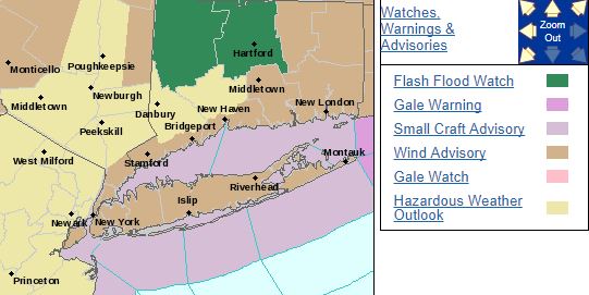
The following potential hazards and impacts are detailed:
Strong Winds: Wind gusts of 30 to 40 mph are likely Tuesday into Tuesday Night. A wind advisory has been issued for coastal and southeastern Connecticut, the NYC boroughs and Long Island, where gusts may approach 45 mph at times. Stronger, damaging wind gusts of 50 to 60 mph are possible in any lines of heavy showers and/or embedded thunderstorms. Downed trees and scattered power outages are possible. For marine interests, a gale watch is now in effect.
UNCERTAINTY: While we are confident in a period of heavy rain and strong southerly wind gusts across the region, the predictability of the timing of the heaviest rainfall, and locations, along with the threat of damaging wind gusts remains uncertain.
For the latest forecasts, updates and discussions, please monitor www.weather.gov/okx