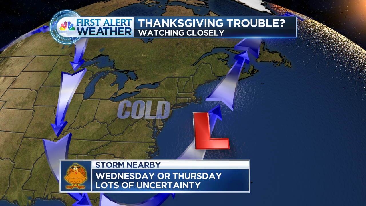
Over the weekend Darren Sweeney began talking about a possible storm for the busiest travel day of the year. It is looking more likely that we will see ‘something’ on that day. In fact, the National Weather Service (NWS) has issued a Winter Storm Watch.
Darren says: "At this point there is still some model spread as to how close a fairly strong area of low pressure will pass by. Some model data wants to hug the coast with the storm, which isn’t the best track for all snow."
The Breakdown: It looks like rain or a rain/snow mix will develop on Wednesday morning. Snow will be wet to start (especially a mix with rain and sleet along the shore) so accumulating snow may take some time to get going ( (at least on roadways) because temperatures will be on the milder side at the very start. Once the sun sets and the storm intensifies, temps will drop and the snow will begin to accumulate. There is a chance we could see 6+ inches of snow especially in northern and n/eastern CT.
If you’re not traveling on Wednesday, it tends to be one of the busiest errand days of the year getting ready for the holiday. No matter what happens on Wednesday night, the storm will leave us with a mix of clouds and sun on Thanksgiving morning but it will be breezy, the wind could be a problem for the Macy's Parade big balloons.
The GOOD news for all of you, the storm should be pulling away by Thursday morning and snow will taper during the early morning hours.
The bottom line: If you have any travel planned Wednesday morning through Thursday morning, stay tuned to the #FirstAlertCT forecast team. On Darren's blog, on the web you can find both the text and video First Alert Forecast.
- This Afternoon Widespread fog. Otherwise, mostly cloudy, with a high near 65. South wind around 11 mph, with gusts as high as 29 mph.
- Tonight Widespread fog before 8pm. Otherwise, partly cloudy, with a low around 46. South wind 9 to 13 mph, with gusts as high as 25 mph.
- Tuesday Mostly sunny, with a high near 53. West wind 9 to 14 mph, with gusts as high as 25 mph.
- Tuesday Night Increasing clouds, with a low around 34. West wind 5 to 8 mph.
- Wednesday Rain before 2pm, then snow. High near 38. North wind 6 to 9 mph. Chance of precipitation is 80%. New snow accumulation of less than a half inch possible.
- Wednesday Night Snow, mainly before 4am. Low around 30. Chance of precipitation is 80%.
- Thanksgiving Day A chance of snow showers before 7am. Mostly cloudy, with a high near 40. Chance of precipitation is 30%.
- Thursday Night Mostly cloudy, with a low around 22.
- Friday Mostly sunny, with a high near 37.
- Friday Night Partly cloudy, with a low around 23.
- Saturday Partly sunny, with a high near 38.
- Saturday Night Mostly cloudy, with a low around 26.
- Sunday Mostly sunny, with a high near 40.
Follow NBC Connecticut Meteorologist Darren Sweeney on Twitter: @DarrenSweeney