Winter Storm Warnings and Advisories in Effect!
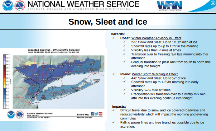
National Weather Service (NWS) is predicting 3 to 6 inches of snow and sleet with snowfall rates of up to 1” in the morning. Reduced visibilities and snow/ice covered roadways will create difficult travel for morning and evening commute.
Below is the NWS summary of the expected weather today, Tuesday, February 12.
Potential high travel impact for both the morning and evening commutes
Snow begins this morning for the NYC metro and then works northeast across the remainder of the area
Precipitation transitions to a wintry mix during the late morning into afternoon hours from south to north. There is some uncertainty with how quickly this transition occurs. Small timing differences will have significant impacts on snowfall and ice totals.
Ice Accumulations of up to ¼ inch across Interior and 1/10th inch along the coast.
Rainfall amounts of ½ to 1 inch, mainly coast, including NYC/NJ metro
Learn more here.