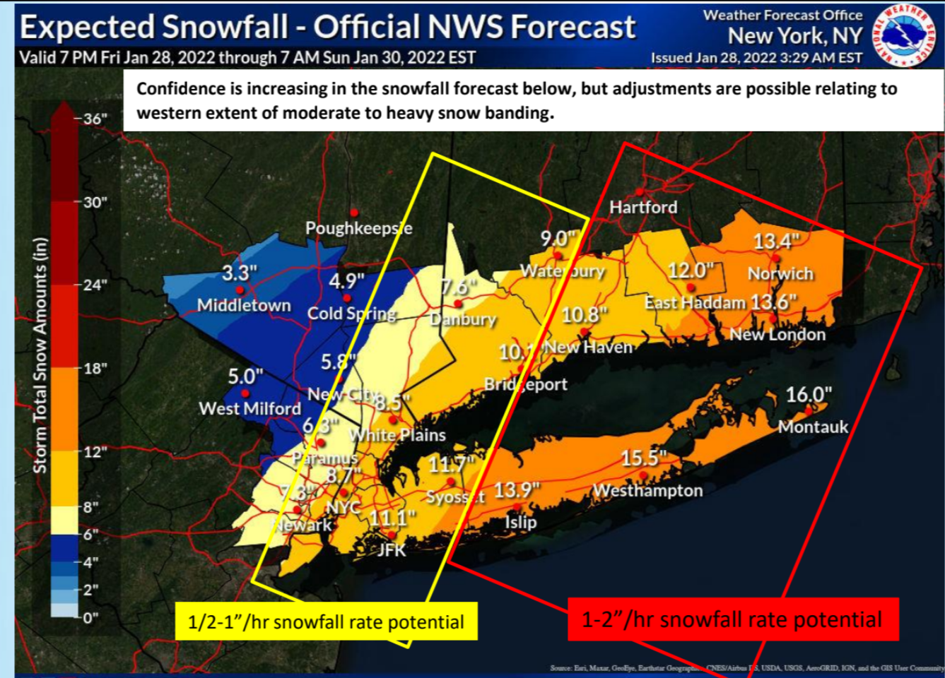


A strong winter storm will bring a period of moderate to heavy snowfall and strong winds to much of the area, starting tonight and continuing through Saturday. Near blizzard conditions are possible for a period on Saturday for the eastern portions of the area.
10 - 16” of snow likely and strong winds across LI and SE CT tonight into Saturday evening. Dangerous travel and blizzard conditions are possible.
5 - 10” of snow and strong winds likely across NYC, NE NJ, SW CT tonight into Saturday afternoon. Difficult travel and blowing snow possible.
Minor to locally moderate coastal impacts are possible for the vulnerable twin forks, north shore of LI and north shore of barrier island
shoreline communities for the Saturday AM/PM and Sunday AM high
tides.
Confidence is increasing on forecast snowfall, but there is still uncertainty on the western extent and/or duration of moderate and
heavy snow banding late tonight into Saturday.
What has Changed:
- Forecast snowfall amounts have increased for most of the region.
- Winter Storm Warnings are in effect for the entire area except Orange County, NY where a Winter Weather Advisory is in effect.
- Storm Warning issued for the ocean waters for Saturday.
Please see the PowerPoint briefing in this post for details on the potential hazards and impacts from this event.
Stay alert, by monitoring NWS New York, NY forecasts, NOAA weather radio, television and radio news, cable and satellite weather programming, and commercial services, as well as the following NWS resources...
B