A warm front will bring a widespread moderate to locally heavy rainfall late Thursday night, December 27 into Friday evening. The onset of precipitation Thursday night across the interior of the Lower Hudson Valley and interior southern Connecticut may be accompanied by a brief light wintry mix of freezing rain, sleet, and snow. Any wintry mix will quickly change to plain rain early Friday morning.
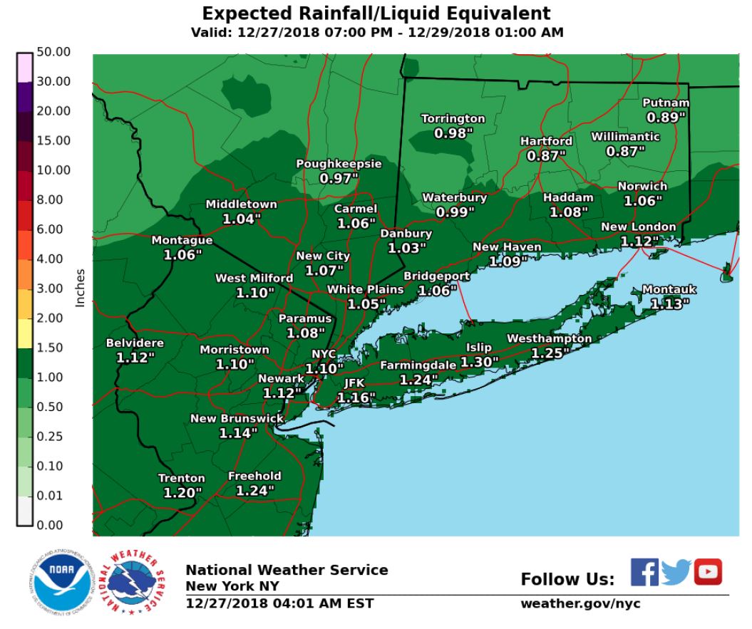
WHAT: Rainfall amounts of 1 to 1.25 inches with locally higher amounts possible. A brief light wintry mix of freezing rain, sleet, and snow possible at the onset.
WHERE: Rainfall across the entire forecast area. The brief light wintry mix is at precipitation onset and only across the interior of the Lower Hudson Valley and interior southern Connecticut
WHEN: Thursday night into Friday evening.
Potential Hazards and Impacts:
Rainfall amounts 1 to 1.25 inches are forecast with locally higher amounts
This may lead to localized minor urban and poor drainage flooding.
Minor flooding along quick responding rivers/streams is possible due to the amount of rain in recent weeks.
Wintry Mix:
This is only possible across the interior of the Lower Hudson Valley and interior Southern Connecticut at the onset of precipitation Thursday night,
Little to no accumulation is forecast, but any untreated surfaces could become slick with even just trace amounts of ice.
Any wintry mix quickly changes to rain by daybreak Friday.
Learn more here