
A Winter Weather Advisory has been issued for our entire area from Thursday morning, February 18 into Friday afternoon, February 19.
Weather overview
A light to moderate snowfall is likely Thursday, with periods of light snow or wintry mix continuing Thursday Night into Friday.
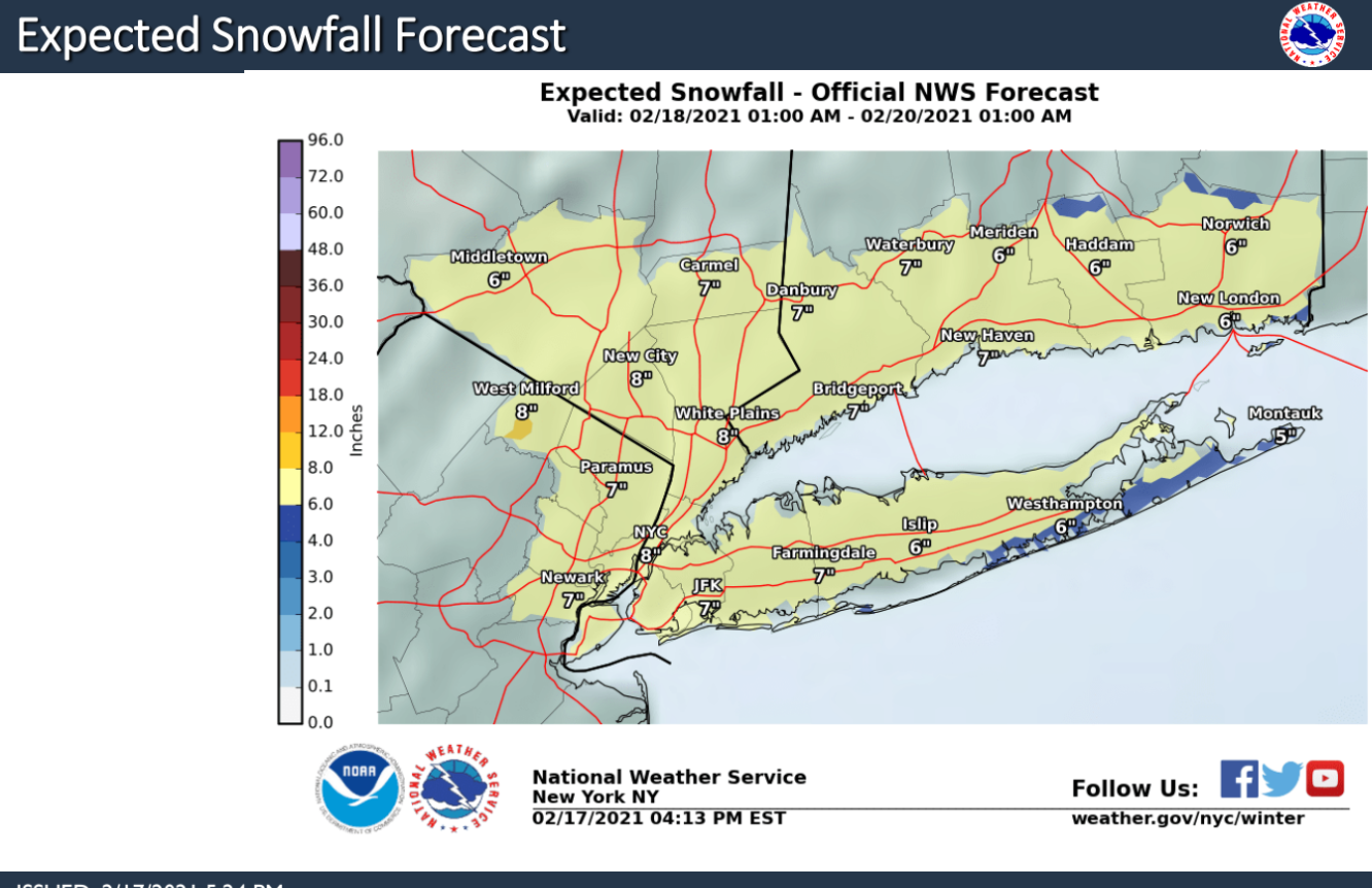
A widespread 3-6“ of snow is expected by Thursday evening with an additional 1-3” Thursday night into Friday, totaling 5-9” for much of the area by Friday evening.
A light glaze of ice is possible for NYC/NJ metro and NW LI Thursday night into Friday morning.
Snow covered roads, poor visibilities, and hazardous travel are expected for the Thursday morning and evening commutes, and possible for the Friday morning and evening commutes.
TIMING & LOCATION
Snow will overspread the area between 6 and 10 am Thursday morning from west to east. Up to 1” of snow is possible for NYC metro, NE NJ and Lower Hud by 8am.
Heaviest snow likely occurs late Thursday morning into the late afternoon, with snowfall rates of up to 1”/hr possible. Snow becomes light Thursday Eve. Light snow may change to a light wintry mix for LI and the NYC/NJ metro Thursday evening.
Periods of light snow are expected to continue well into Friday, ending from west to east Friday afternoon into evening.
FORECAST CHALLENGES
Banding could result in locally heavier snowfall amounts (6-8”) during the day on Thursday. This will have to refined as the event unfolds Thursday morning.
Snowfall amounts Thursday night and Friday will depend on track and timing of low pressure. A track farther south and east than the current forecast would result in little to no accumulation during that period.
Learn more here.
D