Chance of Snow Tonight, Tomorrow, More Significant Winter Storm Possible Sunday
Two quick-moving systems will bring renewed chances for wintry precipitation to the region tonight, Thursday, February 28 into Friday morning, March 1 and again late Friday night into the day on Saturday, March 2. A third, potentially more significant, system is forecast to impact the region Sunday evening into Monday morning.
Tonight into Friday Morning
- Hazard: A light snowfall is expected across the region late tonight into Friday morning, with snow developing after midnight and continuing through daybreak before tapering off. The best chances for light accumulating snowfall will be across Long Island, New York City, and northeast New Jersey.
- Snow Amounts: Snowfall amounts will range from a coating across the Lower Hudson Valley and interior southern Connecticut to around 0.5 inches in the New York City Metro area.
- Impacts: Travel may be hazardous during the Friday morning commute due to a combination of poor visibility and slippery roads.
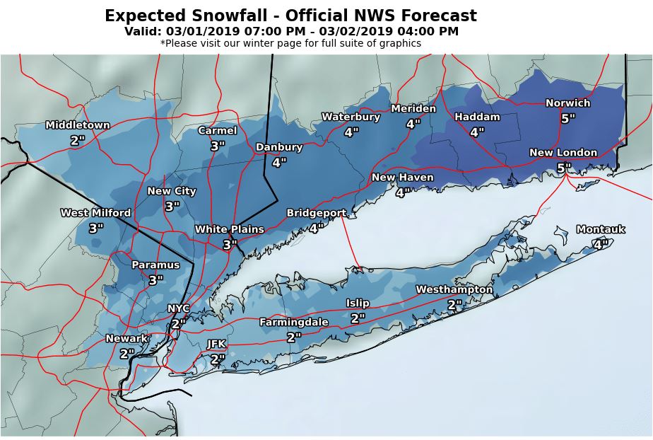
Friday Night into Saturday:
- Hazard: Wintry precipitation returns to the region Friday night and continues into Saturday morning, tapering off from west to east by Saturday afternoon. While a brief period of snow is possible as precipitation begins, any snow will quickly mix with sleet across Long Island, New York City, and urban northeast New Jersey. Farther north, precipitation is expected to fall as all snow throughout the entire event. Any mixed precipitation then changes back to all snow Saturday morning before coming to an end.
- Snow Amounts: Potential snowfall amounts of 1 to 3 inches for the NYC/NJ metro and Long Island, 2 to 4 inches for the Lower Hudson Valley and northeastern NJ, to as much as 4 to 6 inches across southeastern Connecticut.
- Impacts: Travel may be hazardous Friday evening through Saturday morning due to a combination of poor visibility and snow and sleet covered roads.
Sunday Evening into Monday Morning:
- Hazards & Uncertainty: A more significant storm system may impact the region Sunday evening into Monday morning. Considerable uncertainty remains at this time with respect to the track of the surface low, although the potential exists for significant snow accumulations across at least a portion of the forecast area.
- A storm track farther offshore would result in colder temperatures and more snow closer to the coast.
- A storm track farther inland would result in warmer temperatures and would confine any snow accumulations to the interior.
- Impacts: This system has the potential to impact the Monday morning commute.
Additional Information and Resources can be found here
N