![]()
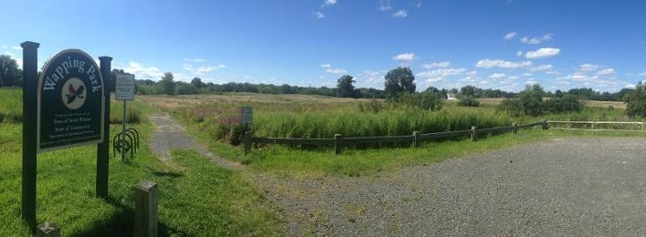
Governor Ned Lamont today announced that his administration is awarding $6.2 million in funding to protect and preserve open space lands across Connecticut, including $5.5 million to support 29 grants toward the purchase of nearly 3,000 acres of land, plus an additional 5 grants totaling more than $700,000 for distressed communities to promote the use of open space in urban settings.
The grants are authorized under the state’s Open Space and Watershed Land Acquisition Program and the Urban Green and Community Garden Program, which are administered by the Connecticut Department of Energy and Environmental Protection (DEEP) and assist local governments, land trusts, and water companies in purchasing land to protect as open space. These open spaces have tremendous value for the state by protecting wildlife habitat, offering recreation opportunities, and protecting ecosystems that are sequestering carbon.
“Our administration has set high goals to mitigate the effects of climate change and implement policies that better preserve our air, water, and natural resources,” Governor Lamont said. “This program is an important component of preserving some of the best and most beautiful land in the world, and by partnering with our municipalities and nonprofits we can ensure that these valuable resources are preserved in perpetuity for generations to come.”
“Open space is key to ensuring a bright economic future for our state,” DEEP Commissioner Katie Dykes said. “These natural assets are valuable as we attract and retain residents who are increasingly looking for varied recreational opportunities where they work, play, and live. No single entity can accomplish the critical goal of protecting our lands with significant conservation values now and for future generations. We need continued cooperation of land trusts, our towns and cities, and conservation-minded citizens to build upon existing and form new partnerships and new approaches to protecting open space.”
Today’s projects bring the total land in Connecticut designated as state or local open space to more than 512,000 acres – approximately more than three quarters of the way toward the state’s goal of having 673,210 acres designated as open space.
DEEP’s 2021 grant rounds for both of these grant programs are now underway, with applications due by September 30, 2021. These programs use funding from the Community Investment Act and state bond funds and require matches by the grant recipient and stipulations that the land be protected by a conservation and public recreation easement, ensuring that the property is forever protected for public use and enjoyment. Projects are evaluated by statutorily defined parameters and ranked, according to natural resource and recreational value, and natural area resiliency and adaptation to mitigate climate change. Updated applications for the 2021 grant round are available on DEEP’s Open Space website.
The grants announced today include:
Open Space and Watershed Land Acquisition Grants
Town: Bethany
Project Name: Van Epps Preserve
Sponsor: Bethany Land Trust, Inc.
Grant: $15,900
Total Area: 6.9 acres
Description: This parcel located at 380 Beacon Road straddles Bethany and Beacon Falls. It lies adjacent to the east block of the Naugatuck State Forest to the north and west, the Bethany Land Trust preserves to the south, and the town owned Bethany Veterans Memorial Park to the southeast. The parcel is flat on the southern side before gradually rising where it abuts the ridge of the state forest. It is primarily forested with mature, second growth trees. The public can access the property from Route 42 via an old pasture road. Two cold water streams on the property flow through Mendel’s Folly into Hockanum Brook. The Natural Diversity Database identifies this area as containing State and Federal Listed Species.
Town: Cheshire
Project Name: Moran/Fenn Road Property
Sponsor: Town of Cheshire
Grant: $202,500
Total Area: 45.1 acres
Description: The Town of Cheshire is seeking to acquire this property that abuts their 201-acre DeDominicis open space property as well as a 10-acre town owned open space parcel to the south. The acquisition will protect approximately 2,600 feet of the Mill River riparian corridor and 18 acres or wetlands. The Mill River is a tributary to Lake Whitney, a public water supply reservoir. A trail will connect this property to the trails on the DeDominicis property by means of an historic wood road and a planned footbridge over the Mill River. The southern end of the property contains an 80 feet bluff overlooking the Mill River and a large glacial erratic. The property has been approved for a 6-lot subdivision. It contains 19 acres of prime or important agricultural soils. The property lies 8 miles from Waterbury and 9 miles from New Haven.
Town: Colchester
Project Name: Sablitz Property
Sponsor: Town of Colchester
Grant: $63,000
Total Area: 65 acres
Description: This property is located at the southern end of the State-designated Pine Brook Greenway. Wetlands on the property feed into Pine Brook which runs along its western boundary. Pine Brook is a tributary of to the Jeremy River, both of which have Class A designation. Almost the entire property has been designated as an “Aquifer Protection Zone.” The conservation of this property would protect 2,600 feet of riparian area. The town plans to connect this property to the Richard Goodwin Trail and will construct a gravel parking area for 8-10 vehicles as well as a picnic area.
Town: Colebrook
Project Name: Sandy Brook Forest Preserve
Sponsor: Colebrook Land Conservancy, Inc.
Grant: $117,600
Total Area: 146.8 acres
Description: This area of undeveloped land is situated on Phelps Flat and Beech Hill Roads in Colebrook. Most of the property – 120 acres – is core forest and is part of a regional forest block that includes Algonquin State Forest, Colebrook Land Conservancy’s Phelps Research Area, Aton Forest, and Sandisfield State Forest. Sandy Brook (3,780 linear feet) and North Brook (2,749 linear feet) flow through the property creating 60 acres of riparian habitat before flowing into the Farmington River. An NDDB letter dated April 14, 2020 lists six rare State-listed species of animals and plants on or near the site including Jefferson salamander, Red bat, Slimy sculpin, Eastern pearlshell mussel, Early coral root, and Skunk currant. Property features including forested swamps, lands adjacent to freshwater wetlands, and riparian lands adjacent to cold water streams ranks the property highly in climate resiliency.
Town: East Haddam
Project Name: Hayward Parcel – O’Connell Road Extension
Sponsor: Town of East Haddam
Grant: $96,900
Total Area: 124 acres
Description: This 124-acre parcel is located on the east side of O’Connell Road Extension in East Haddam. It is mostly forested and contains mainly oak trees but also has maple and beech trees. It contains a large red maple wetland and at least one large vernal pool. It is located at the headwaters of the Eightmile River Watershed and is part of a greenbelt that extends from Hamburg Cove in Lyme through the Eightmile River watershed to the Salmon River Watershed. The parcel is part of the Lyme Forest Block Important Bird Area and supports a variety of woodland-nesting bird species. It is part of an extensive series of protected open space.
Town: East Hampton
Project Name: Christopher Property
Sponsor: Town of East Hampton
Grant: $46,500
Total Area: 7.5 acres
Description: This property contains Christopher Pond, an approximately 1.3-acre pond fed by Christopher Brook, a direct tributary to Lake Pocotopaug. The brook contributes approximately 21% of the total water load into the lake. This City is motivated to purchase this property in the hopes of protecting the water quality of the brook and in turn improving the water quality of the lake which suffers from cyanobacteria blooms every summer. There is a series of protected parcels upstream (to the south) of Christopher Brook including land owned by the Town of East Hampton (5 acres), a Middlesex Land Trust Preserve (3.5 acres), and a 52 acre open space parcel known as Spice Hill Woods. If acquired, the public would have use of the property for fishing, kayaking, hiking, and picnicking.
Town: East Lyme
Project Name: Pattagansett River Watershed Phase II
Sponsor: East Lyme Land Trust
Grant: $330,000
Total Area: 132 acres
Description: This proposed 132-acre parcel is adjacent to the East Lyme Land Trust’s Phase I property that DEEP funded in the 2019 grant round, that abuts the 301-acre Darrow Pond Open Space. Both parcels are adjacent to over 4,000 acres of protected open space including the Yale University Forest, Nehantic State Forest and a trail connection to the 14-mile Goodwin Trail. The subject property includes 3,500 feet of frontage on Pattagansett Lake and 500 feet of frontage on the Pattagansett River. This property protects half of the public drinking water supply for the Town of East Lyme. The forest is made up of 100-year-old hardwoods with a high diversity of tree and shrub species. Forested wetlands cover about 10 acres and are found in two locations. A forest management plan has been developed for the property. Open fields that were likely hay lots or pasture cover 10 acres of the property. The public will be able to access the property for fishing along 2,000 feet of lakeshore. The East Lyme Land Trust will use the property as a teaching forest and will provide linkages between open space parcels including the existing 14-mile Goodwin Trail.
Town: Easton
Project Name: 18 South Park Ave, Easton, CT
Sponsor: Aspetuck Land Trust
Grant: $188,000
Total Area: 18.7 acres
Description: The Aspetuck Land Trust seeks to acquire 18.7 acres of land along with Mill River in Easton to be incorporated into the Warner Angler Preserve which would more than quadruple its current area. The property has 3,300 linear feet of riverine bank and the opposing riverbank is dedicated Town of Easton Open Space. The acquisition of this parcel would allow the public access for fishing, hiking, and wildlife viewing. This section of the Mill River, which sits below Easton Reservoir is classified as a Class 1 Wild Trout Management Area and supports populations of wild Brook Trout and wild Brown Trout. An NDDB letter dated June 19, 2020 shows the Eastern box turtle, Wood turtle and Sharp-shinned hawk to be known species in the area.
Town: Greenwich
Project Name: Converse Brook Preserve
Sponsor: Town of Greenwich and Greenwich Land Trust
Grant: $400,000
Total Area: 72.3 acres
Description: This project is a collaborative effort to acquire 72 acres of Class III land from the Aquarion Water Company. The property is wooded with wetlands throughout and is part of a larger 800-acre open space corridor that includes the Greenwich Land Trust’s 52-acre Westfall Preserve, 297-acre town-owned Babcock Preserve and 453-acres of Aquarion Water Company properties. This area of protected land is adjacent to the Mianus River Greenway. The property contains a cold-water stream, Converse Pond Brook which runs down the western side of the property. Wetlands, small streams, and vernal pools make up a wetland system surrounding the brook. The property is less than a mile from Putnam Lake Reservoir. An NDDB review found that a known hibernaculum for Northern Long-eared Bat and other bat species is located within ¼ mile of the project. An existing horse trail system will be improved and expanded to allow for public access to the property.
Town: Groton
Project Name: Watrous Property
Sponsor: Town of Groton
Grant: $352,000
Total Area: 161 acres
Description: This 161-acre property contains Eccleston Brook, a Class A watercourse, and its associated tributaries which flow south through the property and into Palmer Cove. Palmer Cove is a high-quality estuary. Forty-two acres of contiguous wetland surround Eccleston Brook. A DEEP sampling of the brook found a wild brook trout population. Other species observed in the brook include American ell, golden shiner, redfin pickerel, and tessellated darter. A Tier 1 vernal pool on the property provides breeding habitat for Wood frogs, Spotted salamanders, Marbled salamanders, and Fairy shrimp. A study of the vernal pool by a local wetland scientist found over 800 egg masses, 1,000 wood frogs and over 1,000 salamanders over a two-week period during a springtime breeding migration. Acquisition will provide a link between town-owned open space to the north and south and will provide for nearly 200 acres of protected land between Route 1 and I-95. A preliminary NDDB review shows Eastern box turtles and Wood turtles to be present in or near the area. The forest cover is mainly beech, oak and maple. Wetland vegetation includes Red Maple, Swamp Azalea, Common Alder and Northern Spicebush.
Town: Guilford
Project Name: Bartlett Land Preserve, Bluff Head
Sponsor: Guilford Land Conservation Trust
Grant: $127,500
Total Area: 64 acres
Description: This 64-acre property is part of a traprock ridge at the northern reaches of Totoket Mountain in North Guilford. Totoket Mountain is part of the Metacomet Ridge. The parcel is surrounded by over 400 acres of protected open space owned by the Guilford Land Conservation Trust, the South-Central Regional Water Authority and the Town of Guilford. It contains a wetlands area and lies within the Coginchaug River watershed. The Connecticut Forest and Park Association has Blue-Blazed trails on the property for public use. This acquisition will ensure that the public can continue to use these trails in perpetuity. The GLT will also be acquiring an open space parcel to the east to be incorporated into the preserve.
Town: Hebron
Project Name: Bernstein Property
Sponsor: Town of Hebron
Grant: $199,960
Total Area: 215.5 acres
Description: The Bernstein property is a relatively large parcel of land containing mature forest, agricultural fields in various stages of succession, brook corridors, and wetland corridors. It is located adjacent to the State’s Air Line Trail State Park as well as other Town of Hebron Open Space parcels. The southern boundary runs along Judd Brook, a Class A stream that flows into the Jeremy River. The Jeremy River becomes the Salmon River just a few hundred feet from the property’s boundary. Eight state listed species are known to occur within or close to the boundaries of the property according to a June 24, 2020 NDDB preliminary assessment. Frontage on Old Colchester Road will allow for public access via a small parking area and trailhead. The Town of Hebron hopes to establish a small trailhead accessible from the Air Line Trail.
Town: Litchfield
Project Name: Williams Property/Horse Show Meadow
Sponsor: Ripley Waterfowl Conservancy
Grant: $310,000
Total Area: 38.7 acres
Description: This property abuts 110 acres of conserved land to the west and connects Ripley’s 150-acre preserve to the north with the 4,000-acre White Memorial Foundation nature preserve to the south. It contains open fields and riparian woodlands. Two branches of Butternut Brook, both Class AA streams, run along each side of the property feeding Bantam Lake. According to the NDDB, the property contains alluvial marsh and six species of rare plant and animal species including American kestrel, Eastern meadowlark, New England sedge, Stiff gentian, and Pale green orchid. Thirty-two acres of the property contain USDA Prime or Statewide Important Soils. The meadows are hayed by a local farmer and will continue to be maintained that way after purchase. The White Memorial Foundation, adjacent to the property has over 246 recorded bird species. A hiking trail, boardwalk, and fishing stream will allow the public to enjoy the property. It is accessible from Route 202 and is less than 10 miles from the City of Torrington.
Town: Meriden
Project Name: 100 Hanover Street
Sponsor: City of Meriden
Grant: $18,690
Total Area: 0.46 acres
Description: The City of Meriden plans to acquire this site for the proposed extension of the regional Quinnipiac Linear greenway trail. It is part of the city’s Harbor Brook Flood Control and Linear Trail Master Plan. If acquired, it would help the city link the completed section of this passive recreational trail in North Meriden to the Meriden Green Park and other parts of the city. Harbor Brook runs through the property which feeds the Quinnipiac River.
Town: Middlefield
Project Name: Pogmore Properties
Sponsor: Town of Middlefield
Grant: $159,900
Total Area: 88.9 acres
Description: This proposed acquisition is made up of 3 irregularly shaped parcels made up hay fields and mixed deciduous forest. The properties abut the Coginchaug River and are located in a 100- and 500-year flood zone. Durham Meadows State Wildlife Area is located to the North and the Lyman Orchards Gold Club is located to the west and south. There is a wetland and small finger pond on the property. The total wetland area for the three parcels is approximately 20 acres. Over 60 acres or prime farmland and over 21 acres of statewide important farmlands are located here. A preliminary assessment by the NDDB found the Northern Leopard Frog and the Bronze Copper to be located on or near the property. The property will be used for passive recreational opportunities and continued agricultural use as a hayfield.
Town: Norfolk
Project Name: Kopp Property
Sponsor: Norfolk Land Trust, Inc.
Grant: $328,000
Total Area: 235 acres
Description: This large property directly adjoins the Norfolk Land Trust’s Hall Meadow Brook and East Branch Headwaters preserves. It is a significant link between other large blocks of protected land such as the Great Mountain Forest and Dennis Hill State Park. According to The Nature Conservancy, the property “has been identified as part of a large resilient landscape in Northwest Connecticut”. It contains 210 acres of core forest including upland and forested wetland habitats. The upland forest includes Central Appalachian Oak-Pine and Mixed Northern Hardwood sub habitats. The NDDB identifies the following State Listed Species of Special Concern in or on the vicinity of the property: Silver-haired bat, Red bat, Hoary bat, Slimy sculpin, Shar-lobed hepatica, Summer sedge, Squirrel corn, Goldie’s fern, Skunk currant, and Canada violet. The property has ponds and wetlands that form headwaters for Lake Winchester and both branches of the Naugatuck River.
Project Name: Wyndham Land Trust
Sponsor: Townshend Property
Grant: $234,000
Total Area: 355 acres
Description: This large parcel is surrounded by undeveloped land. Once acquired, there will be 1,400 acres of protected land in the immediate area. According to the Nature’s Network Core or Connector Map, half of the property is classified as Priority 1 habitat for terrestrial and imperiled species with the second half being classified as Priority 2 habitat. The property contains the headwaters to Nightingale Brook and has a large forested swamp containing native shrubs. Nightingale Brook flows into the Mashamoquet Brook which flows into the Quinnebaug River. It is part of a core forest that is 3,000 acres in size. The property can be accessed along Quarry Road with many places for cars to pull off creating recreational opportunities for the elderly and people with disabilities.
Town: Ridgefield
Project Name: Bear Mountain Open Space
Sponsor: Ridgefield Conservation Commission
Grant: $42,000
Total Area: 13.8 acres
Description: The acquisition of this parcel will connect a 3-acre parcel of town owned open space to the 386-acre Hemlock Hills open space preserve. It will also help the town of Ridgefield reach its goal of protecting 30% of the town’s land mass as protected open space. The property is mostly wooded and contains native tree and shrub species including American beech, black birch, hickory, blueberry, and mountain laurel. It is part of the Still River Watershed. The property predominantly consists of a steeper forested slope that drains into Miry Brook. The public will be able to access the property through a proposed trail that ascends and runs along the northern peak of Bear Mountain affording views of Danbury and northern Fairfield County.
Town: Salem
Project Name: Ransom Brook House, LLC
Sponsor: Salem Land Trust, Inc.
Grant: $66,300
Total Area: 55.8 acres
Description: This parcel is adjacent to Nehantic State Forest and provides direct access to Hartman Park and the 14-mile Goodwin Trail. It lies within the state’s “Eightmile River Greenway”. It would expand the protected land within the Audubon’s Lyme Forest Block Important Bird Area. The site contains the headwaters of Ransom Brook and contains 3,400 feet of riparian corridor. Other features include vernal pools, upland hardwood forest, beaver ponds and meadows, a great blue heron rookery, rocky outcrops, mixed hardwood/conifer forest, forested red maple swamps, and a cold-water stream. An old woods road will be maintained for public use and will connect to the State Forest. Stone walls and evidence of a colonial mill site at the headwaters of Ransom Brook provide a cultural and educational opportunity for visitors.
Town: Salisbury
Project Name: Belter Lime Rock
Sponsor: Salisbury Association, Inc.
Grant: $250,000
Total Area: 114 acres
Description: The Belter Lime Rock property abuts the Appalachian Trail corridor to the east and the Housatonic State Forest’s Sharon Mountain Forest Block to the south and west. It lies on the northernmost ridge of Sharon Mountain and rises to an elevation of 1150 feet. The land has a spring-fed stream that drains to the Salmon Kill and contains 10 acres of surficial aquifer potential. It contains high-quality wildlife habitat including core forest, meadow, stream, and steep slopes with bedrock exposures and boulders. An NDDB preliminary assessment indicates that 13 State Listed Species are known to occur within or close to the boundaries of the property. The property is an Audubon-designated Important Bird Area. There is a Subacidic rocky summit/outcrop on the property which is a Key Habitat of Greatest Conservation Need under Connecticut’s 2015 Wildlife Action Plan. The public can easily access the property from Connecticut Route 112 off of Route 7 for passive recreation on a planned 1.8-mile loop trail.
Town: Sharon
Project Name: Von Ahn Farm
Sponsor: Sharon Land Trust, Inc.
Grant: $500,000
Total Area: 168 acres
Description: The Von Ahn Farm lies on the western reach of Indian Mountain off Connecticut Route 361 and rises 600 feet to its peak elevation at 1,200 feet. It contains wonderful view sheds and has almost a mile of scenic ridgeline on Indian Mountain. This acquisition would more than double the current protection of Indian Mountain and complete a continuous belt of protected land between Indian Lake and Mudge Pond. The 37 acres of farm fields contain USDA Prime and Statewide Important Farmland soils. There are wetlands and several headwater streams that drain into Indian Lake. The property is contiguous with Sharon Land Trust’s 108-acre Goodbody/Paley Farm Preserve. One hundred and twenty acres of the property is core forest including upland and riparian forested wetlands. Other features of the property include shrub land, steep slopes and rocky outcrops. According to an NDDB preliminary assessment, 11 State-listed rare species occur on or near the property.
Town: Simsbury
Project Name: Meadowood Open Space
Sponsor: Town of Simsbury
Grant: $500,000
Total Area: 138 acres
Description: This is the first stage in a collaborative effort between the Town of Simsbury and the trust for public land to protect a large 288-acre property for open space, trails, historic and cultural significance, farmland, and future athletic fields. The first phase of the project and the purpose of this grant application is to protect a 138 acre segment of the property for open space and the historic preservation of a site Martin Luther King, Jr. lived and worked during two summers in his early adult life through a work exchange program with Morehouse College. Three large tobacco farms on the property will be restored and interpretive signage, focusing on the historical significance and natural resource values will be installed. The State Historic Preservation Office received an American Civil Rights Grant to facilitate placing the property on the National Register of Historic Places. This property connects the 4,400-acre McLean Game Refuge with the Massacoe State Forest linking the two trail systems and creating over 25 miles of trails. The property contains a mixture of forest, wetlands, open fields, and early successional shrublands providing habitat for a variety of wildlife but especially ground nesting bird species. The project will protect 32 acres of both primary town aquifer protection areas and aquifer recharge areas. There are approximately 63 acres of prime and statewide important farmland soils on the 138-acre property. The 2.5 miles of old farm roads will be improved and maintained as hiking trails.
Town: Suffield
Project Name: Falkowski Stearns
Sponsor: Town of Suffield
Grant: $157,500
Total Area: 98.5 acres
Description: The Town of Suffield aims to purchase an easement over this property that is entirely underlain by wither Prime Farmland Soils or Farmland Soils of Statewide Importance. The property is a mix of open fields and forested areas containing hardwood tree species such as white, red, and black oak, tuliptree, and shagbark hickory. There are 6-8 vernal pools on the property and is in the Connecticut River watershed. It encompasses 2600 linear feet of Rawlins Brook, a Class A stream. An NDDB preliminary assessment found four Species of Concern in and around the property including American kestrel, bobolink, wood turtle, and Bush’s sedge. Approximately 16 acres of the property directly east of North Main Street will continued to be used for agricultural purposes. The property owners have a forest management plan for the property.
Town: Warren
Project Name: Cunningham Road
Sponsor: Warren Land Trust
Grant: $500,000
Total Area: 248 acres
Description: This parcel is located between the 263-acre East Kent Hamlet Preserve and the 336-acre block of the Wyantenock State Forest. Its protection will add to an existing 790 acres of contiguous adjacent protected lands and would build upon a network of 948 acres of existing protected lands within a 1 mile radius. The property falls within the Mohawk Block Important Bird Area. In June 2020, a pair of Cerulean Warblers and Broad-winged Hawks were identified on the property. The property’s forest habitats include 145 acres of Mixed Northern Hardwoods, 42 acres of Central Appalachian Oak and Pine Forest, and 50 acres of Forested Inland Wetlands. According to the Environmental Protection Agency’s Greenhouse Gas Equivalent Calculator, the property is storing roughly 15,376 metric tons of carbon and can sequester an additional 100 metric tons of carbon annually. There is an extensive network of upland wetlands and cold-water stream habitats on the property as it straddles the headwaters of both the West and East Aspetuck Rivers. There are 104 acres of Prime, Statewide Important, and Locally Important Farmland Soils on the property.
Town: Warren
Project Name: Tanner Farm
Sponsor: Warren Land Trust
Grant: $500,000
Total Area: 201 acres
Description: The Tanner Farm lies adjacent to 51 acres of agricultural land preserved by an ACEP-ALE easement. Within 2 miles of the farm are 2400 acres of open space. A 4,000-foot segment of Sucker Brook (a Class 1 Stream) runs through the property. This brook is the largest single water source for Lake Waramaug generating over 60 percent of its water. The northern reaches of the property contains 55 acres of core forest located at the southern end of a larger 230-acre forest block. The property’s upland core forest area, grasslands, cold water streams, and upland forested wetlands provides a wide array of wildlife habitat. The farm has almost a mile of frontage on both Route 341 and Angevine Road and is visible from Route 45 making it an important viewshed for the town. The Tanner Farm has been in operation for over 150 years and the Warren Land Trust intends to continue agricultural use of the property.
Town: Washington
Project Name: Bantam Preserve
Sponsor: Steep Rock Association, Inc.
Grant: $166,500
Total Area: 31 acres
Description: This property, along with two others presented in this grant round, is part of the Steep Rock Association’s conservation initiative to expand its 676-acre Hidden Valley Preserve and connect to Mount Tom State Park and Wyantenock State Forest north to the blue-blazed Mattatuck Trail. This acquisition would expand the protection of a 1,216-acre core forest and lies within a mile of 1,656 acres of protected land. It contains 77 feet of riparian habitat along the Class AA/2 Bantam River. Other important features include 6 acres of wetland, a 1-acre swamp, 550 acres of cold-water stream, and an alluvial swamp within floodplain forest. The parcel is located within the Shepaug Forest Block Important Bird Area. The Steep Rock Association plans to install a 2.1-mile spur trail from the existing Mount Tom State Park trail system.
Town: Washington
Project Name: Cook Preserve
Sponsor: Steep Rock Association, Inc.
Grant: $376,000
Total Area: 65 acres
Description: This 65-acre property is directly contiguous to the Steep Rock Association’s 68.9-acre Bronson Fields parcel. It contains 0.8 miles of riparian habitat as it abuts the Shepaug River. A 0.58-mile section of the dismantled Shepaug Valley Railroad runs through the site creating a flat, easily accessible hiking trail for the public. It is part of the 13,800-acre Shepaug Forest Block Important Bird Area. Other features include four vernal pools, 9 acres of Dry Oak-Pine Forest, a 0.22-mile perennial tributary of the Shepaug River, and 8 acres of north-central interior and Appalachian rich swamp. The parcel contains 11 acres of wetland alluvial and floodplain soils and swamp. Much of the site contains USDA Prime and Statewide Important Farmland Soils.
Town: Washington
Project Name: Mount Tom Preserve
Sponsor: Sponsor Steep Rock Association, Inc.
Grant: $193,500
Total Area: 73 acres
Description: This property is directly adjacent to DEEP’s 231-acre Mount Tom State Park and forms part of a 1,216-acre intact core forest block. The property contains 7 acres of wetland soils, 52 acres of core forest, and 0.25 miles of dry sub acidic ridgeline. It also protects two GAA-drinking water wells at nearby Rumsey Hall School. Approximately 1,480 acres of protected open space exist within, or interest, a 1-mile buffer of the property and it is located within the 13,000-acre Shepaug Forest Block Important Bird Area. The property forms the uphill border of Romford Road which directly borders the Shepaug River. It is largely mountainous and contains four subpeaks (990’, 1040’, 1060’, 1090’). Forest types include Central Appalachian Dry Oak-Pine Forest, North-Central Interior and Appalachian Rich Swamp.
Town: Wilton
Project Name: Fratelli Zeta Acquisition
Sponsor: Aspetuck Land Trust
Grant: $157,500
Total Area: 11.5 acres
Description: This property is part of the Aspetuck Land Trust’s project to create a 705-acre contiguous forest known as the Weston/Wilton Forest Block. The ALT will create a recreational trail system through the properties with the central trailhead at the Fromson Strassler property which they are acquiring with assistance from a 2020 OSWA grant. The forest block will be connected to the Norwalk River Valley Trail at the Cannondale Station in Wilton. Hiking trails in the forest block will also be linked to Huntington State Park in Redding via Georgetown Road. There are intermittent watercourse and seepage wetlands on the property that contribute to the headwaters of the West Branch of the Saugatuck River. The intermittent stream channel and bordering vegetated wetlands provide habitat for amphibians.
Urban Green and Community Garden Grants
City: Hartford
Project Name: Affleck Street Community Garden
Location: 154 Affleck Street, Hartford
Sponsor: KNOX, Inc. & City of Hartford
Grant: $6,900
Description: This project will improve public access at this community garden (established June, 2011) by installing 8 accessible raised garden beds, 2 picnic benches, and a small pavilion. The new garden beds will allow 8 additional Hartford residents to access garden plots. The pavilion will provide shade for gardeners on hot summer days and act as an outdoor classroom. The garden is open to all members of the public and to Hartford residents for low cost plot rentals. KNOX, Inc provides gardeners with access to seeds, soil, amendments, hand tools, and education. Once this project is complete 20 families will have access to raised garden beds.
City: Meriden
Project Name: Meriden Green Expansion
Location: Mill & Cedar Streets
Sponsor: City of Meriden
Grant: $400,000
Description: This project will expand the Meriden Green which was completed in 2016. The site is the former location of the Mills Memorial Apartments, which the city demolished in 2018. The goal of the project is to create an urban sensory park with gardens and other features that allow patrons to touch, smell, hear, see, and taste. Project elements include a small amphitheater, an outdoor classroom area, sculptures, seating walls, boardwalks, a bioswale and sensory gardens. The project will be managed by the city’s Department of Public Works and its Department of Parks and Recreation.
City: New Haven
Project Name: Mill River Trail Urban Green Space
Location: Haven & Exchange Streets, New Haven
Sponsor: City of New Haven & Save the Sound
Grant: $50,000
Description: This project will build a visible and accessible entrance to the Mill River Trail in Fair Haven by converting 4 blocks of degraded roadway and vacant land into a linear trail and green stormwater-capture park. It will provide community access to the City-built Mill River Trail to the north, the recently upgraded Criscuolo Park to the south, and to the Mill River. This project will include the removal of degraded pavement and invasive plants, construction of a pervious trail system and park entrance, and installation of interpretive signage and benches. Modifications to the site include the replacement of more than 104,000 square feet of impervious surface with a more natural landscape and management and diversion of more than 2.4 million gallons of storm water each year. Green infrastructure will also reduce persistent flooding at the adjacent John S. Martinez School playground.
City: Stamford
Project Name: Open Air Pavilion
Location: 151 Brookdale Road, Stamford
Sponsor: Bartlett Arboretum Association, Inc. & City of Stamford
Grant: $175,000
Description: This grant will contribute to the construction of a 2,400 square foot open air pavilion at the Bartlett Arboretum and Gardens to be located adjacent to the Silver Educational Center. The pavilion will be open to the public and will be accessible to educational groups like the Boys/Girls Scouts, the UCONN Master Gardener’s program, and other community groups. Guests will have access to the pavilion during the Arboretum’s summer concert series, and community festivals. The City of Stamford owns the project site and the Bartlett Arboretum Association is responsible for managerial and operations oversite through a lease agreement with the City. The Bartlett Arboretum and Gardens is accessible to the public free of charge. The pavilion will have ADA accessible ramps leading to the main platform from both the main road and the Silver Educational Facility that provides access to restroom facilities. Picnic tables for the pavilion have been designed to accommodate wheelchair access.
City: Willimantic
Project Name: Lauter Park Community Gardens
Location: Philip Lauter Park, 561 Jackson Street, Willimantic
Sponsor: Town of Windham
Grant: $69,139
Description: This project will increase visitor experience and productivity at two Philip Lauter Park garden sites. This project includes the construction of a community gathering place, an outdoor classroom and shared beds for all visitors and gardeners, the development of sustainable practices through pollinator beds, soil building and season extension. The garden sites are part of the Town of Windham’s parks system and are managed jointly by the Town, GROW Windham, and the Windham Area Interfaith Ministry.