The National Weather Service has issued a Hazardous Weather Outlook as strong gusty winds and moderate to heavy rain are likely tonight into early Friday morning.
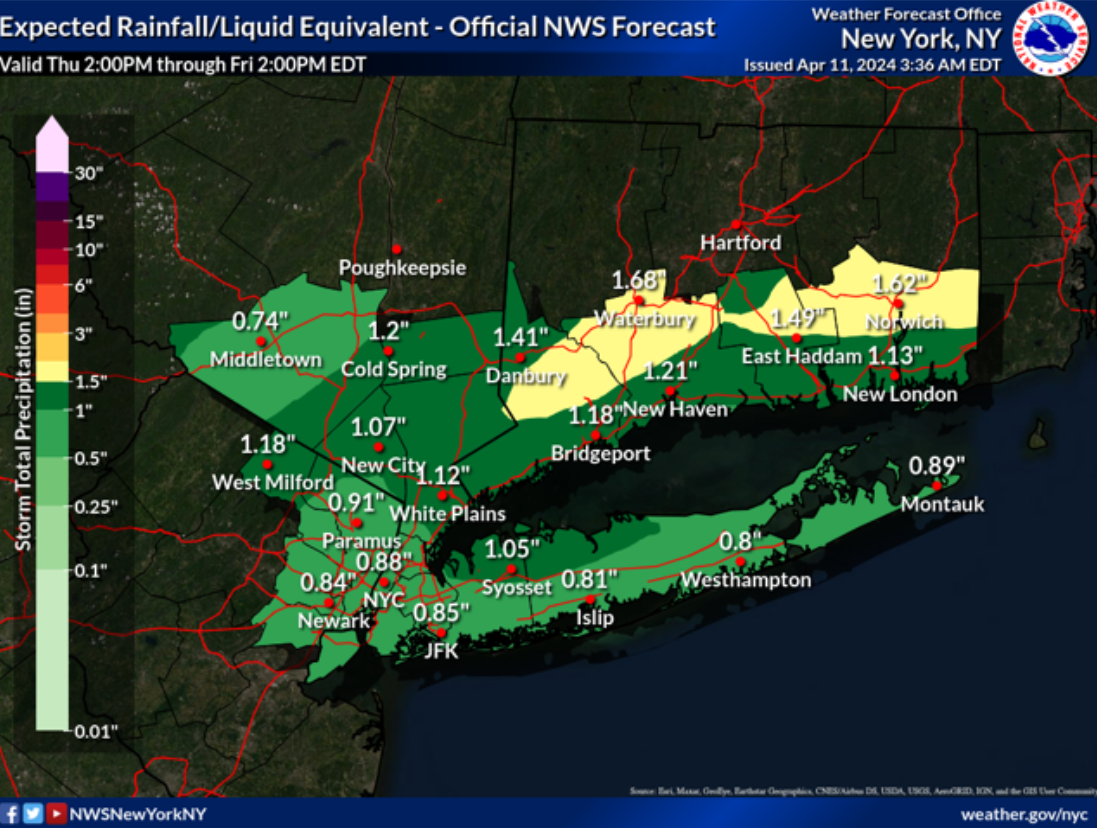
A strong frontal system approaches today and crosses through Friday morning. The front will bring moderate rain, with embedded pockets of heavy rain starting late this afternoon and this evening, and ending Friday morning. An isolated embedded thunderstorm will be possible as well tonight into early Friday morning.
Key Messages:
1. Gusty winds are expected to begin this evening and continue into Friday morning. Wind gusts up to 40 to 45 mph are forecast during this timeframe, especially closer to and along the coast. A few wind gusts of 50 mph may occur briefly along the coast towards and just before dawn. A Gale Warning is in effect for the coastal waters tonight through Friday for the ocean and eastern non-ocean waters, and through the first half of Friday for the western non-ocean waters.
3. Widespread minor to locally moderate coastal flooding is expected for tonight's high tide cycle. Coastal flood advisories are in effect, with a Coastal Flood Watch now issued for coastal Nassau on Long Island. Heavy rain could exacerbate coastal flooding concerns.
Learn more here.