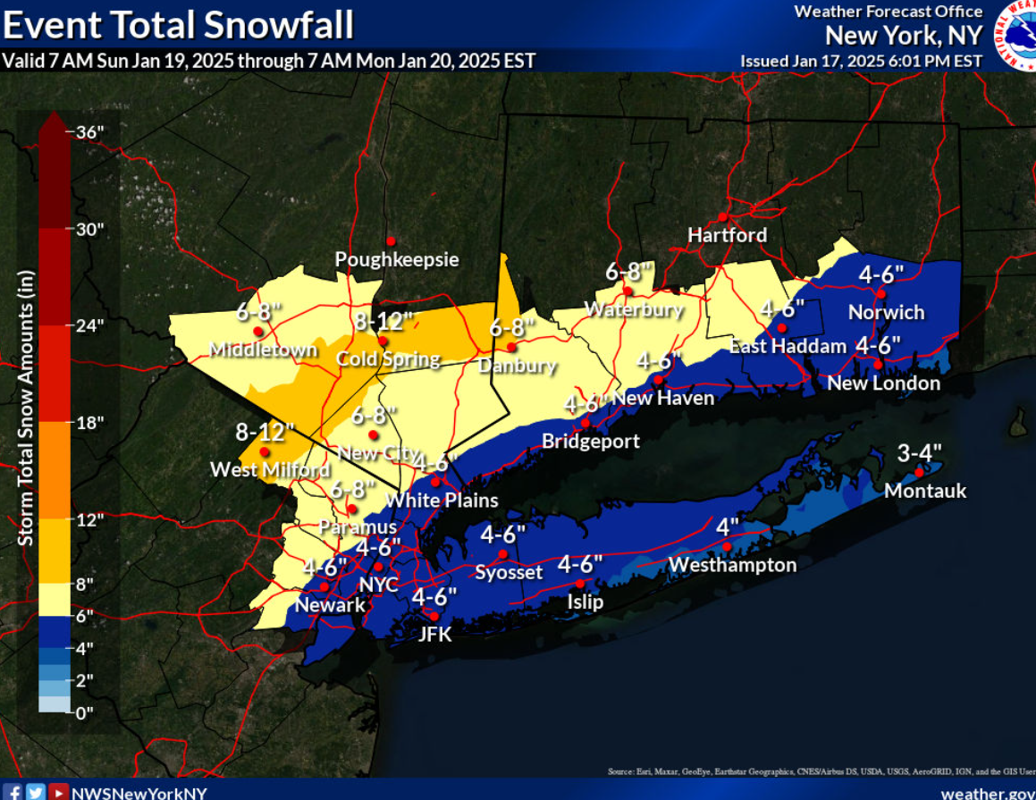
National Weather Service has issued a Winter Storm Watch from Sunday afternoon, January 19, 2025, through late Sunday night.
- What to Expect: Heavy snow is possible, with total snow accumulations of 5 to 8 inches.
- Locations Affected: Portions of southern Connecticut, northeast New Jersey, and southeast New York.
- Timing: From Sunday afternoon through late Sunday night.
Precautions:
- Delay travel: If possible, postpone all travel plans.
- Drive cautiously: If travel is unavoidable, exercise extreme caution and be prepared for sudden changes in visibility.
Forecast
Sunday:
Snow, mainly after 1 PM. Temperatures falling to around 30°F by 5 PM. Wind chill values between 20°F and 25°F. North winds at 7 to 9 mph. Chance of precipitation: 80%. New snow accumulation of 3 to 5 inches possible.
Sunday Night:
Snow, mainly before 1 AM. Low around 14°F. Northwest winds around 11 mph, with gusts up to 22 mph. Chance of precipitation: 80%. New snow accumulation of 2 to 4 inches possible.
M.L. King Day (Monday):
Mostly sunny, with a high near 23°F.
Monday Night:
Mostly clear, with a low around 4°F.
Stay Updated:
Visit the National Weather Service website or check specific forecasts for your area here.
H