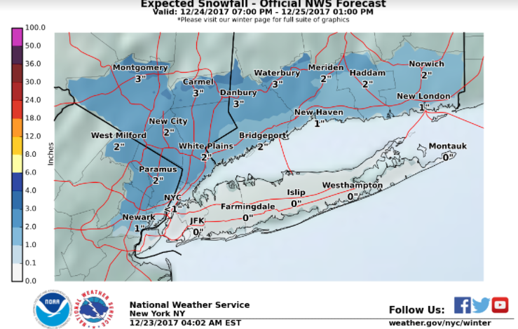
Updated holiday weather forecast from National Weather System for Orange, Putnam counties in southeast NY and Southern CT
Late Christmas Eve through Christmas morning
A mixture of rain and snow is expected. Highest probability for an all snow event is across interior portions of Northeastern New Jersey, the Lower Hudson Valley, and SW Connecticut, with moderate potential for a plowable snow. Snow will likely mix with or remain plain rain closer to the coast.
Christmas Day
Precipitation tapering off early Monday morning. West/northwest winds 25 to 35 mph with gusts of 35 to 45 mph likely Monday, with low potential for a few 50 mph gusts.
Christmas night
Diminishing winds. Temperatures falling into the teens and 20s. This will likely start an extended period with temperatures struggling to get much above freezing through mid to late week.
Stay tuned to your latest NWS forecasts here
R