Very cold temperatures and low wind chill values continue through next Tuesday.
- Temperatures are forecast to average 15 to 20 degrees below normal through Tuesday.
- Widespread near to subzero wind chill temperatures are expected Saturday night, Sunday night, and Monday night. Subzero wind chills could continue into Monday afternoon, primarily across parts of Connecticut and the Lower Hudson Valley.
- Both frostbite and hypothermia are concerns. Particular care will be needed for the homeless and elderly populations.
- To prepare your home, read our latest Publication Information Statement:
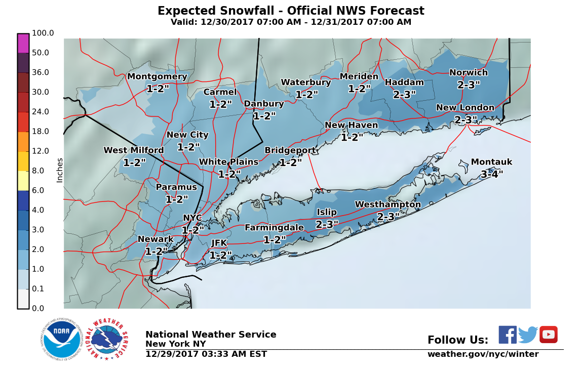
hereThe potential continues to increase for an accumulating, and possibly plowable, snowfall for portions of the region on Saturday.
- 2-3 inches of snow is likely across Suffolk County, NY and Middlesex and New London counties in CT. Elsewhere, 1-2 inches of snow is expected with the exception of western Orange County, where less than an inch is likely. View the weather map for details on snow total amounts.
- Please note that there is still some uncertainty with the track and intensification of this system, so there is still a 1 in 10 chance of seeing more than 3 to 6 inches.
Stay tuned to your latest NWS forecasts for the latest on this storm and the cold: http://www.weather.gov/okx
R