The is a strong potential for another major winter storm tonight into tomorrow, according to NOAA
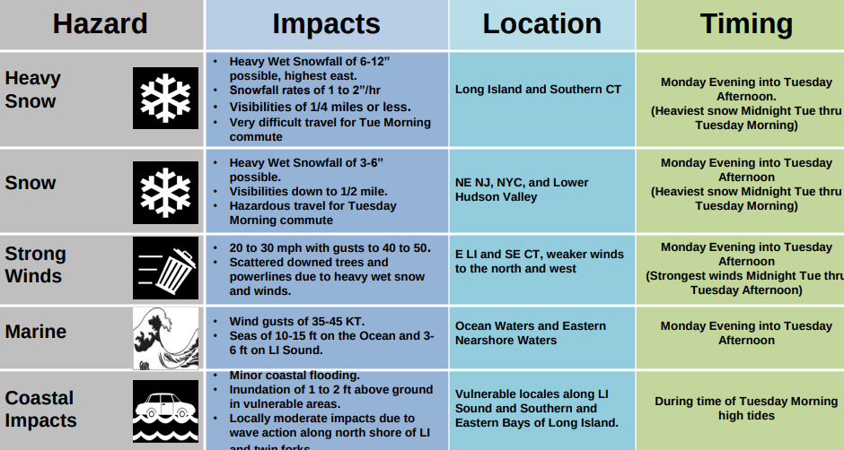
Winter Storm Watch expanded to all of Long Island and Southern Connecticut for Monday night, March 12 into Tuesday, March 13.
Heavy Wet Snowfall possible (6 to 12 inches) for Long Island and Connecticut
Scattered downed trees, tree limbs and powerlines
Snowfall rates 1 to 2 “/hr and Visibilities ¼ mile or less at times
Very difficult travel for the Tuesday morning commute
Strong northerly winds of 20 to 30 mph with gusts 40 to 50 mph for LI and SE CT.
Gale conditions expected over most of the local waters.
Minor to locally moderate coastal impacts possible for LI waters and Southern CT during Tuesday morning high tide
Visit the National Weather Service online HERE for winter weather updates.