NOAA is forecasting light accumulating wintry mix for interior portions of the region late tonight into Tuesday morning. Strong winds are possible on Wednesday.
An approaching warm front will bring a light accumulating wintry mix of snow, sleet and perhaps freezing rain to interior portions of northeastern NJ, Lower Hudson Valley, and southern Connecticut late tonight into Tuesday morning. In the wake of a strong cold frontal passage late Tuesday night, strong winds are possible across the entire Tri-State region late Tuesday night into Wednesday evening.
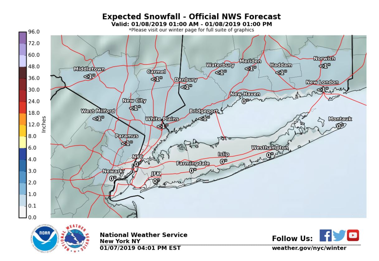
Snow/Sleet/Ice
Hazard: A light accumulation of snow and sleet is likely across Interior portions of northeastern New Jersey, the Lower Hudson Valley, and southern Connecticut between 2 am and 10 am. Freezing rain or drizzle may mix in or a period of freezing drizzle is possible late Tonight into Tuesday morning when precipitation becomes lighter
- Total Snow and Sleet Accumulation of less than an inch is likely.
- A trace to a few hundredths of an inch of ice accumulation is possible.
NWS New York Website: https://www.weather.gov/okx/