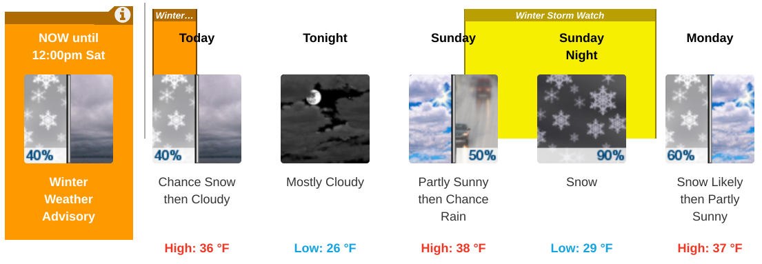
Winter Weather Advisory remains in effect until noon today, Saturday, March 2Storm Total Snow/Sleet Amounts:
Sunday Evening into Monday Morning: A Winter Storm Watch is in effect for most of the region Sunday afternoon through early Monday morning.
- 1 to 4 inches for the NYC/NJ metro and Long Island (highest amounts northern and western points of this area)
- 3 to 5 inches for the Lower Hudson Valley, interior NE NJ, and southern Connecticut.
A significant storm system will likely impact the region Sunday evening into Monday morning. Some uncertainty remains at this time with respect to the track of the surface low, although the potential exists for significant snow accumulations across most of the forecast area. Light rain transitions to snow Sunday afternoon into the early evening, last along the coast. A brief mix of sleet is possible with the transition.
Storm Total Snow Amounts:
- 5 to 9 inches for the Lower Hudson Valley, NE NJ, and much of southern Connecticut.
- 4 to 6 inches for NYC, Long Island, and coastal southeastern Connecticut.
- This system has the potential to impact the Monday morning commute due to the combination of poor visibility and snow covered roads.
For additional information visit NWS online here
R