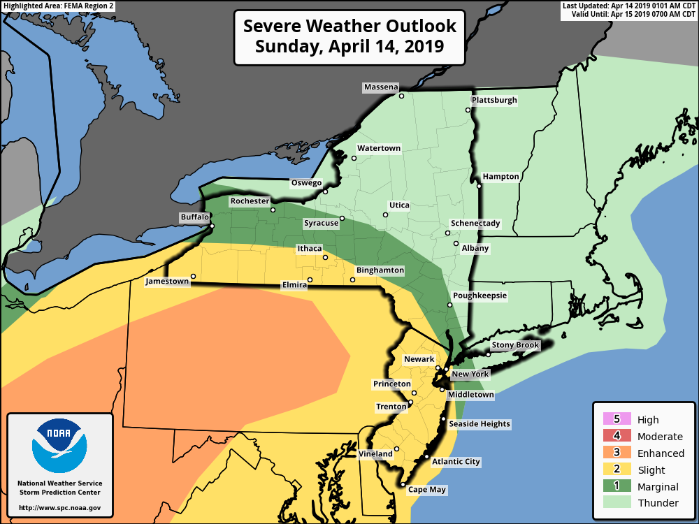
Potential for severe weather Sunday night and Monday morning as a cold front moves through our area.
According to the National Weather Service, there is a slight risk for severe thunderstorms in portions of northern New Jersey, the lower Hudson Valley and western Connecticut with the frontal passage late Sunday night into Monday morning.
Severe Thunderstorms: The main threats associated with any severe storms will be:
- Damaging wind gusts or wind gusts up to 60 mph.
- This could down a few tree limbs, trees and powerlines.
- Isolated power outages are possible.
- Hail up to 1-inch diameter.
Flash Flooding: A basin average rainfall of 0.75 to 1.00 inches is expected.
- Rainfall rates of 0.50 to 1.00 inches/hr are possible with thunderstorms
- Locally heavy rainfall will lead to localized urban and poor drainage flooding.
- Minor flooding is possible along the lower Connecticut River by the middle of this week.
Confidence is increasing that the Monday morning commute may be impacted as a strong cold front moves through the area late Sunday night into Monday morning. The heaviest rainfall is expected to begin around roughly 4 am to 8 am from west to east, with rainfall lasting a few hours at each location.
More info: NWS New York Website: https://www.weather.gov/okx/
R