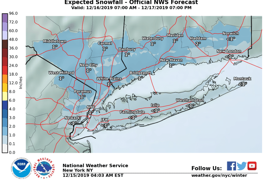

Wintry Precipitation Monday into Tuesday
Winter precipitation is expected to move into the region Monday morning and continue into Tuesday, ending Tuesday evening. The highest amounts of snow and ice are expected across the interior where there will be a longer period of wintry precipitation. Closer to the coast including NYC, the period of snow and wintry mix will be confined to Monday and Monday evening.Travel impacts are possible for the Monday evening commute and for the interior areas, the Tuesday morning and afternoon commutes as well.Forecast Total Snow Accumulations:For the coast including NYC: 1/2 to around 1 inch.For the interior: 1 to around 2 inches.Forecast Total Ice Accumulations:For the coast including NYC: Little to no ice accumulation is expected.For the interior: up to an tenth of an inch.Forecast TimelineMonday:Initially dry but chances of snow will increase from SW to NE late morning into the afternoon, becoming likely across the southern areas mid to late afternoon.Monday night:For the coast including NYC, a wintry mix initially with sleet, snow, and potentially pockets of freezing rain, early in the evening. A transition to plain rain is expected from around 11:00 PM to 2:00 AM. Plain rain continues into daybreak Tuesday. For the interior, a wintry mix of sleet, snow, and freezing rain will become mainly freezing rain and snow after midnight.Tuesday:
For the coast including NYC, rain continues through much of the day. For the interior, a wintry mix, mainly snow and freezing rain will gradually transition from south to north to mostly rain during the afternoon. Pockets of a wintry mix will be possible across the far northwest through the afternoon. A wintry mix returns late Tuesday afternoon into the early evening. All precipitation tapers off by late evening.Learn more here.
R