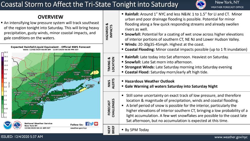


According to the NWS, an intensifying low-pressure system will track southeast of the region tonight, Friday, Dec. 4 into Saturday.
This will likely bring a period of heavy rain, a brief period of snow to the higher elevations of the interior as the storm exits, gusty winds, and minor coastal impacts to the region, as well as gale conditions on our local waters.
The weather map indicates maximum wind gusts up to 29 mph in our area.
Learn more here.
R