
Freezing rain and rain tonight into Wednesday
A weak frontal system will bring light freezing rain to areas just north and west of NYC late tonight, Tuesday, January 4 into Wednesday morning, before changing to rain by mid to late Wednesday morning.
A Winter Weather Advisory has been issued for these areas. There is even potential for Trace ice amounts for NYC and western coastal areas late tonight into early Wednesday morning. With preceding cold air and surface temps over the last 48 hrs, this event may result in icing on untreated and elevated surfaces, and dangerous travel.
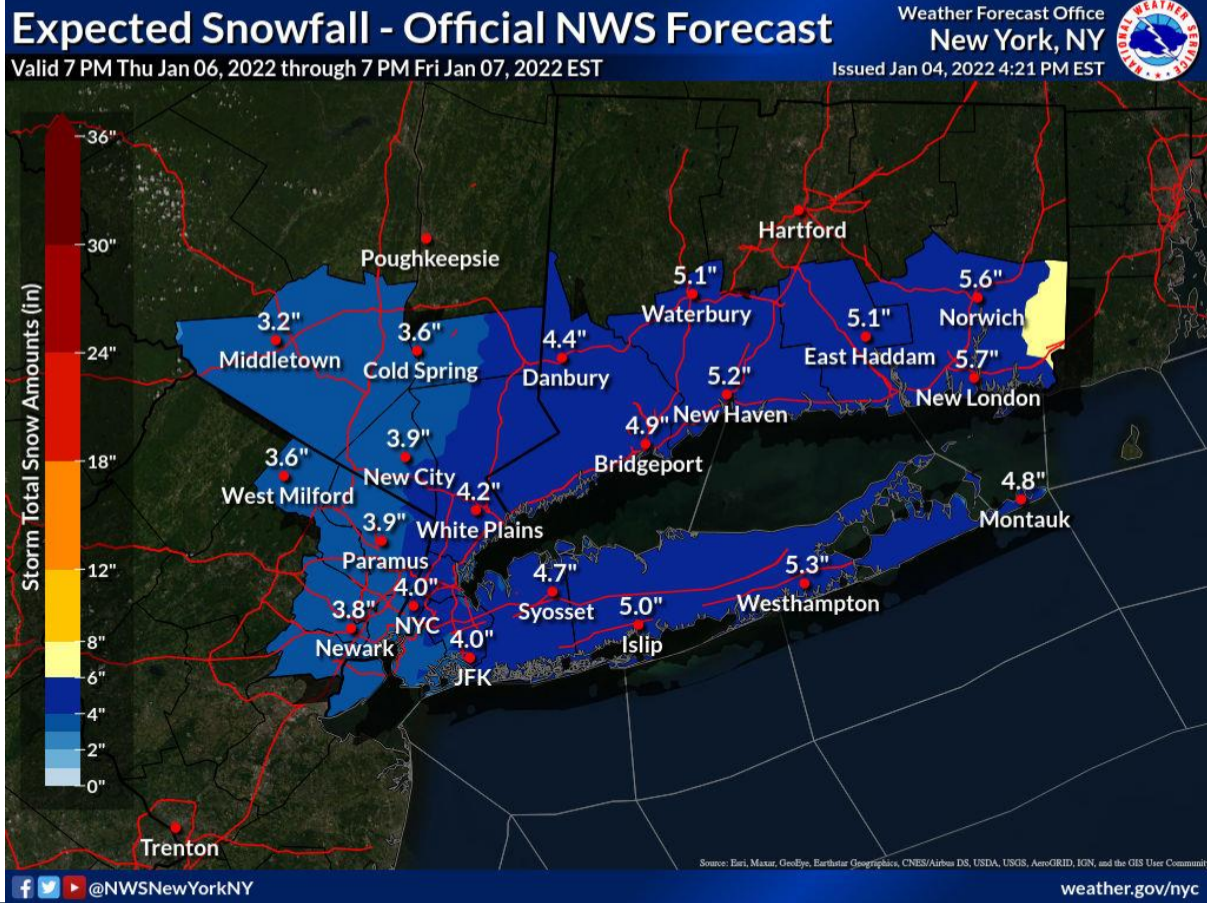
Snow Thursday into Friday
This looks to be a quick-moving system, so the probability of a major (1 ft+) snowfall is very low.
Stay alert, by monitoring NWS New York, NY forecasts
View the weather briefing here.