

Winter blast this weekend! Bundle up and prepare!
An active weather pattern is setting up with arctic air moving in for tonight into Saturday. Then a strong storm system arrives Sunday evening January 16 into Monday morning bringing potentially heavy precipitation, strong winds, and coastal flooding.
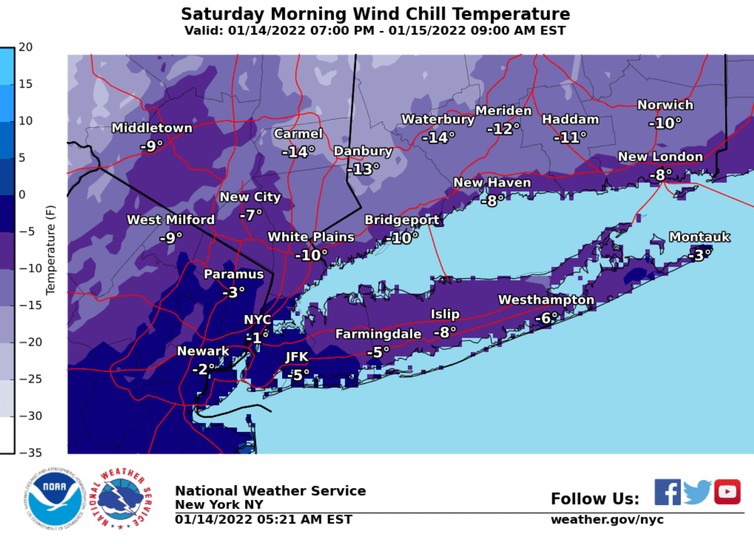
First the extreme cold. Another shot of arctic air arrives tonight into Saturday.
We have the following areas in the map (see images #1 and #2) in a wind chill advisory that is in effect from midnight tonight until 10AM Saturday. These locations are where we are expecting the coldest wind chills by early Saturday morning with wind chills of 15 to 20 degrees below zero as seen in the second image below showing the minimum wind chills expected.
- Temperatures fall into the single digits and lower teens by Saturday morning, with wind chills as low as 5 to 20 degrees below zero.
- High Temperatures on Saturday will only be in the middle teens to lower 20s.
- Another very cold night for Saturday Night with lows in the single digits to a few lower teens and wind chills around 5 to 10 degrees below zero.
The threat for widespread minor to moderate, and possibly major coastal flood impacts across the entire Tri-State coastline continues to increase for the Monday morning high tide cycle, with the combination of an approaching full moon and potential gale to storm force onshore winds. Confidence in magnitude and details of this potential coastal flood event are expected to increase over the next 48 hrs as confidence in storm details increases.
Read more and stay up to date here.
R