
The National Weather Services (NWS) reports that a cold front will be moving through the region Saturday, July 2 into Saturday evening. Ahead of the cold front today, Friday, July 1, temperatures will reach the upper 80s and lower 90s and few showers and thunderstorms are possible.
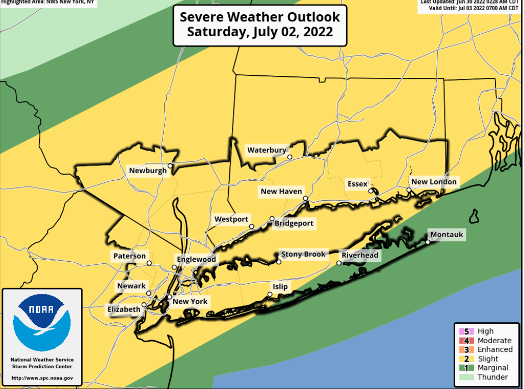
The NWS says that another round of showers and thunderstorms is possible Saturday afternoon and evening. The Storm Prediction Center has placed much of the area at a slight risk for severe thunderstorms.
Locations:
The Lower Hudson Valley, northeast New Jersey, New York City metro, southern Connecticut, and much of Long Island.
Impacts:
Damaging wind gusts (>58 mph) and hail (>1 inch diameter) are the main threats from any thunderstorms that develop. Localized flash flooding is also possible.
Please see attached graphics for additional details. Please visit the NWS New York, NY webpage
R