
National Weather Service has issued a Winter Weather Advisory
The advisory is for the Lower Hudson Valley in SE NY, Interior NE NJ including Eastern Bergen, and Fairfield and New Haven in Southern CT, from 6 pm Friday to 10 am Saturday.
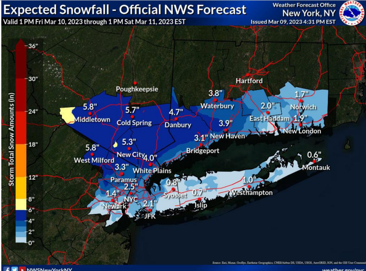
Several inches of snow likely late Friday evening, March 10 into Saturday morning, March 11
The National Weather Service reports that a developing coastal low-pressure system will bring several inches of heavy wet snow to areas just north and west of NYC Friday night into Saturday morning, with a coating to a few inches possible to the coast.
• Lower Hudson Valley, SW CT and interior NE NJ Friday night into Saturday morning: 3 to 6” late Friday evening into Saturday morning. Highest amounts across elevations above 500ft. This will result in snow-covered roads and hazardous travel.
Snowfall Rates: up to 3/4 inch/hr. possible 10pm to 5am
Snowfall Character: wet and heavy
Temperatures: Lower 30s
• NYC/NE NJ metro and Western LI:
1 to 3” of snowfall possible, highest across the northern area. Accumulations mainly on elevated and grassy surfaces.
Visit NWS online to stay up to date on weather conditions https://forecast.weather.gov