
The National Weather Services (NWS) reports that a significant coastal storm will impact the region tonight through Tuesday night, bringing a period of rain and snow, strong gusty winds, and coastal flooding to the Tri-State area. Please read the information below from NWS.
Snowfall:
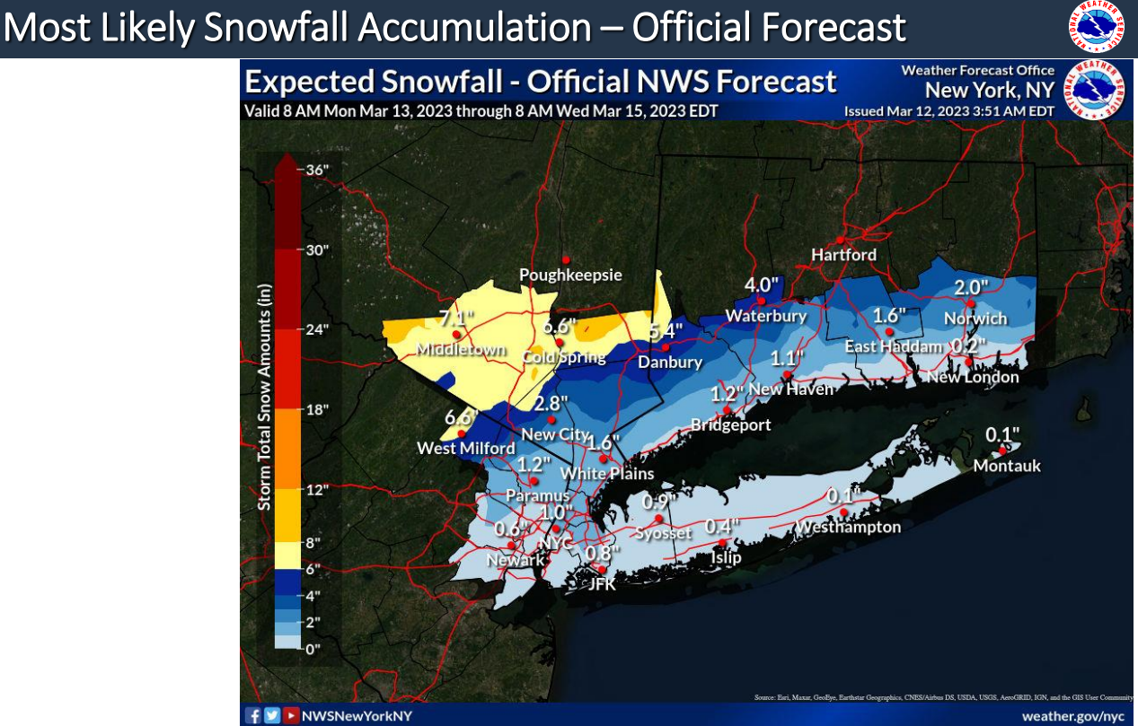
Highest confidence for 6 or more inches of snow will be across Orange and Putnam counties in NY, the northern portion of Fairfield County, and the western portion of Passaic County in NJ.
Lesser amounts are expected as you get closer to the coast.
Rainfall/Liquid Equivalent:
1.50 to 2.50 inches are expected, with locally higher amounts possible, mainly across Southern CT and Long Island.
Wind:
The strongest winds will be Tuesday into Tuesday night with NW winds of 15 to 25 mph with gusts 30 to 40 mph. Some gusts along the eastern portion of Long Island may approach 45 to 50 mph.
Coastal Flooding:
Widespread minor to locally moderate coastal flooding is expected during the times of high tide Monday night into early Tuesday morning.
NWS ALERTS
• Winter Storm Watch: Orange and Putnam counties in NY, Northern Fairfield in southern CT, and Western Passaic in NJ from Monday night through Tuesday afternoon.
• Coastal Flood Advisory: Tonight along the South Shore Bays of Nassau County and Queens.
FORECAST CHALLENGES
There is still some uncertainty at this point to the exact track the storm will take and how much cooling occurs after the precipitation begins. Shifts in the track of the low will impact snowfall/rainfall amounts.