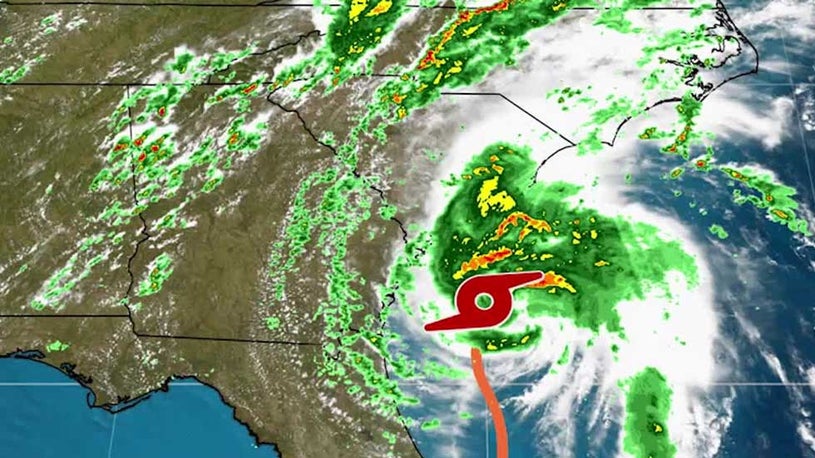
Tropical Storm Isaias (ees-ah-EE-ahs) is expected to regain hurricane strength before it pushes ashore into the Carolinas later Monday with damaging winds, flooding rainfall and storm surge flooding. The storm will then spread those impacts up the East Coast as far north as New England through Tuesday night.
However, the (NOAA) believes the magnitude of local hazards and impacts will increase and Putnam County is now included in the affected areas. The main threats with this system involve heavy rainfall, strong winds, minor to moderate coastal flooding, along with high surf and dangerous rip currents. Locally heavy rain is expected with a widespread 2 to 4 inches, with localized amounts up to 6 inches possible.
The heaviest rain is most likely to occur across New York City, Northeast New Jersey and the Lower Hudson Valley early Tuesday morning through Tuesday evening, and eastern sections Tuesday afternoon into Tuesday night. The strongest winds are likely to occur across Long Island, southern Westchester and southern Connecticut, and the New York City and New Jersey Metro areas.
Dangerous marine conditions are likely across all of the coastal waters Tuesday and Tuesday night. High surf and dangerous rip currents are expected along the ocean beaches Monday through Wednesday. The effects from Tropical Storm Isaias are expected to diminish quickly from southwest to northeast across the area Tuesday night.
POTENTIAL IMPACTS ----------------- FLOODING RAIN: Prepare for life-threatening rainfall flooding having possible extensive impacts across northeast New Jersey, New York City, and the Lower Hudson Valley. Potential impacts include: - Major rainfall flooding may prompt many evacuations and rescues. - Rivers and streams may rapidly overflow their banks in multiple places. Small streams, creeks, canals, and ditches may become dangerous rivers. Flood control systems and barriers may become stressed. - In hilly terrain, destructive runoff may run quickly down valleys, and increase susceptibility to rockslides and mudslides. - Flood waters can enter many structures within multiple communities, some structures becoming uninhabitable or washed away. Many places where flood waters may cover escape routes. Streets and parking lots become rivers of moving water with underpasses submerged. Driving conditions become dangerous. Many road and bridge closures with some weakened or washed out. WIND: Prepare for dangerous wind having possible significant impacts across Southeast New York, Northeast New Jersey, and Southern Connecticut. Potential impacts include: - Some damage to roofing and siding materials, along with damage to porches, awnings, carports, and sheds. A few buildings experiencing window, door, and garage door failures. Mobile homes damaged, especially if unanchored. Unsecured lightweight objects become dangerous projectiles. - Several large trees snapped or uprooted, but with greater numbers in places where trees are shallow rooted. Several fences and roadway signs blown over. - Some roads impassable from large debris, and more within urban or heavily wooded places. A few bridges, causeways, and access routes impassable. - Scattered power and communications outages, but more prevalent in areas with above ground lines.